20+ Beautiful Day Hikes in Central Oregon
We’ve spent several seasons exploring Central Oregon while based in Redmond. These are hikes we’ve personally done and recommend – or that our fellow Oregon experts vouch for. From flat lakeside walks to challenging summit climbs, each trail showcases a different side of Oregon’s high desert, National Forest, or Cascade mountains.
Table of Contents
8 Bucket list hikes in Oregon’s high desert and national forest
Let’s kick off this list with some of our favorite hikes in Central Oregon.
Smith Rock State Park hiking trails
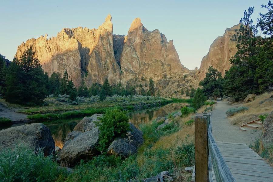
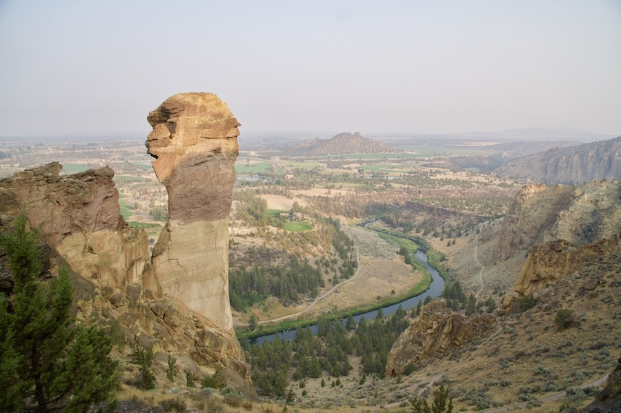
Smith Rock State Park is one of our favorite spots to start hiking in Central Oregon. It’s famous for its rock climbing routes and horseback riding, but the hiking trails give you incredible viewpoints of Crooked River winding beneath towering volcanic cliffs. Expect big desert skies, dramatic rock formations, and plenty of chances to spot wildlife like deer or golden eagles.
- Near: Terrebonne, Oregon (9 miles north of Redmond)
- Elevation: 3,000 ft, with 600 ft volcanic ridge
- Hours: Dawn to dusk (30 minutes before sunrise to 30 minutes after sunset)
- Day-use fee: $5; 12-month parking permit $30
From the day-use parking lot, you’ll descend to the river to begin any of the trails. Choose the steeper Chute Trail if you want a quick start or the Canyon Trail for a more gradual path down.
1. Smith Rock River Trail
This is the easiest trail in the park – flat, unpaved, and great for a first visit. It runs 2.2 miles each way along Crooked River, passing rock faces where climbers are often on the wall. For a longer adventure, connect it with Misery Ridge to form a 3.7-mile loop.
2. Misery Ridge trail
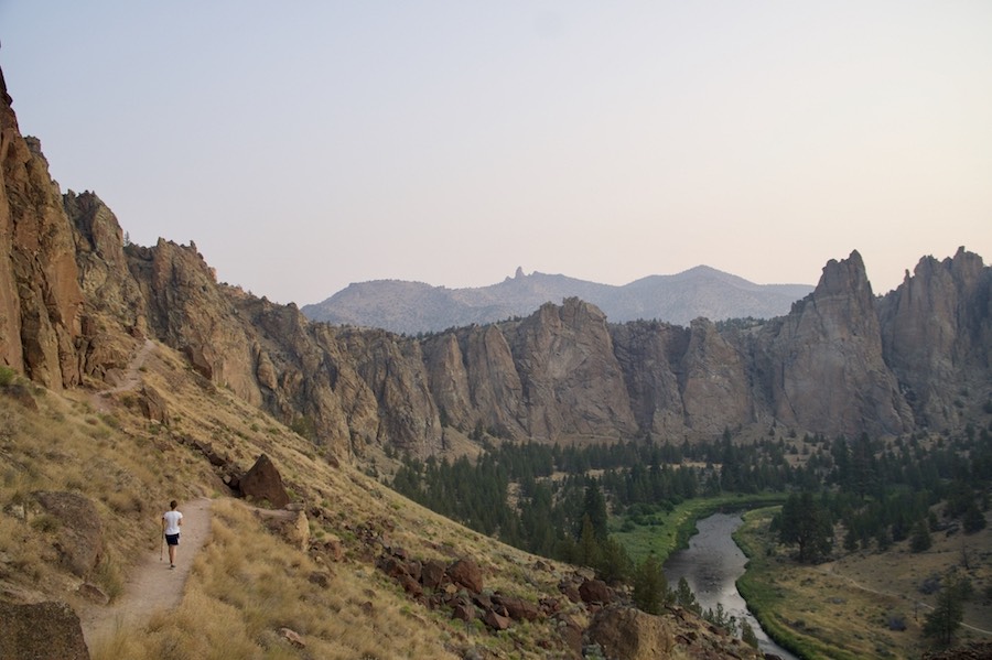
This steep climb lives up to its name, but the views are worth it. It’s less than a mile of steady uphill switchbacks before leveling off at the top of the ridge, where you’ll get sweeping views of the park. Continue over the ridge to see the iconic Monkey Face rock formation and loop back on the Mesa Verde and River trails.
When to visit
The best weather is in late spring, early summer, and fall. Weekends and holidays can be crowded, so we aim to arrive just after sunrise. By the time we finish our hike, the parking lot is usually filling up fast.
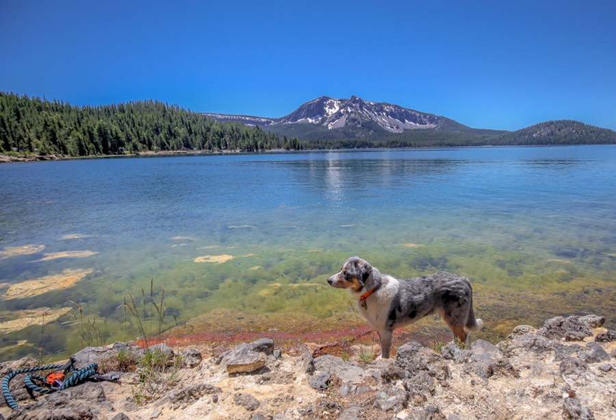
3. Paulina Lake
- Near: La Pine, Oregon
- Distance: 7.8-mile loop
- Difficulty: Easy, flat terrain
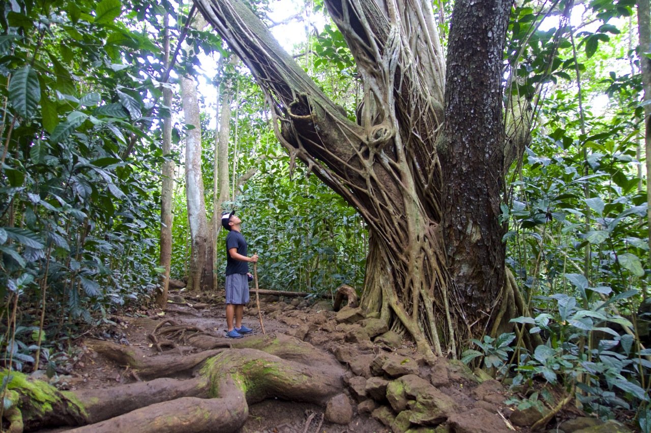
With its turquoise waters and sandy shore, it’s easy to mistake Paulina Lake for the tropics. However, this high alpine lake is the result of the eruption and collapse of the Newberry Volcano that occurred some 75,000 years ago.
Located about an hour and a half from Bend, hikers can enjoy the flat 7.8-mile hike that circumnavigates the lake. During cooler weather, users can take advantage of the shoreside hot springs, thanks to the geothermal activity from the volcano.
Look for the rock pool left by other users on the north side of the lake, about a mile from the resort. Be sure to pack a shovel to create your perfect soaking pool.
If you’d like to camp nearby, there are a few campgrounds or you can opt for some of the backcountry campsites at North Cove Beach.
Contributed by Long Haul Trekkers
4. Black Butte trail

- Near: Sisters, Oregon
- Distance: 1.9 miles one way
- Elevation gain: 1,600 ft
- Difficulty: Moderate to strenuous
- Pass required: Northwest Forest Pass
The Black Butte hike is a steady forested climb that rewards you with some of the best Cascade views in the area. On a clear day, you can see Mount Jefferson, the Three Sisters, Mount Washington, and even Mount Hood in the distance.
The trail ends at a historic ranger cabin and an active fire lookout station. Bring layers, as the summit can be windy even in summer.
5. South Sister hike

- Near: Bend, Oregon
- Distance: 11 miles out and back
- Difficulty: Strenuous, loose terrain
Just 45 minutes outside of Bend, Oregon are three gorgeous sister mountains, aptly named, North Sister, Middle Sister, and South Sister.
While South Sister is the youngest of the three, she is the boldest, tallest, and hardest to climb. The trail is about 11 miles in and back out and is not for the faint of heart.
The terrain makes this hike especially hard. As you’re summiting, the ground is filled with moving rock and dirt so for every few steps up, you slide back down a bit. When you finally make it to the top, everything becomes worth it.
You get some incredible views of the nearby mountains like Broken Top and Three Fingers Jack, and of course, the two other Sisters below. I’d highly suggest proper shoes and even a walking stick to make your life easier while doing this hike.
Contributed by: Where in the World is Nina
Tumalo Falls hikes

Tumalo Falls is a must-do for waterfall lovers in Central Oregon. Located west of Bend in the Deschutes National Forest (note: it’s not close to the town of Tumalo!), the main waterfall is visible right near the parking lot, but the best hiking happens beyond that first view.
Expect multiple waterfalls, creekside trails, and some elevation gain. A Northwest Forest Pass or $5 day-use fee is required. Arrive by 9 a.m. on summer weekends since the parking lot fills and cars spill onto the roadside.
6. Half-mile hike to Tumalo Falls

- Near: Bend, Oregon
Distance: 0.5 miles round trip
Elevation gain: ~200 ft
Difficulty: Easy
Even if you only have 20 minutes, it’s worth the short uphill trail for a different angle on the waterfall. Starting from the day-use parking area, follow the North Fork Trail to a viewpoint from the top of the cascade. This is the steepest section of the trail, but it’s short and manageable for most hikers.
7. North Fork Trail out-and-back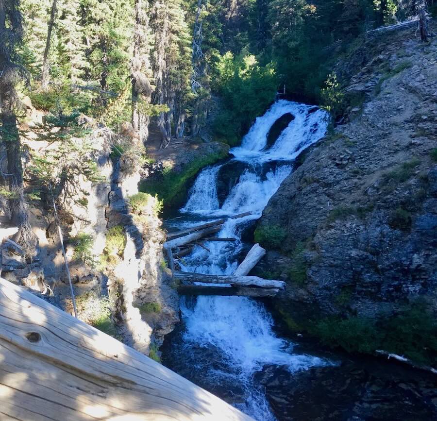

Distance: 4–6 miles round trip
Elevation gain: ~800 ft
Difficulty: Moderate
Continue past the main falls to find a string of waterfalls along Tumalo Creek. The trail gradually climbs through forest, with Double Falls and Middle Tumalo Falls around the two-mile mark.
You can turn around here for a shorter 4-mile hike or continue farther to Spring Creek Trail or Swampy Lakes junction for additional waterfalls. Watch for mountain bikers. Bikes are allowed one-way only on this trail.
 8. Tumalo Falls loop
Distance: 7.2 miles
Elevation gain: ~1,100 ft
Difficulty: Moderate to strenuous
For avid hikers, the full loop takes you past 8–10 waterfalls. After climbing to Swampy Lakes/Spring Creek junction, the trail returns via Bridge Creek Trail. Be prepared to ford or balance across logs where the trail crosses the creek, and note that the second half of the loop has less shade and more sun exposure.
Central Oregon Hikes Map
Here are the locations of the trailheads we mention in this post. You can read a short description when you click on a point, or you can open the full list by clicking in the icon in the top left corner.
Other Hikes Near Redmond Oregon
Steelhead Falls trail
Steelhead Falls is a short and scenic hike along the Deschutes River, ending at a dramatic waterfall tucked into a rocky canyon. It’s a popular spot for fishing, summer swimming, and even cliff jumping, though the trail itself is worth the visit just for the views.
- Near: Crooked River Ranch
Distance: 1 mile round trip (0.5 miles each way)
Elevation gain: ~14 ft
Difficulty: Easy, with loose ground in spots
The trail winds through a canyon with interesting rock formations, so don’t forget to look up from the river now and then. The walk is generally easy, but the loose ground can be slippery. Hiking poles help but it may not be ideal for small children.
Expect wildflowers in spring, icy patches in winter, and the chance to spot wildlife like otters.
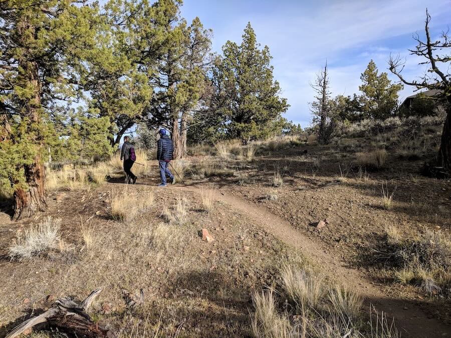
Cline Butte Loop trail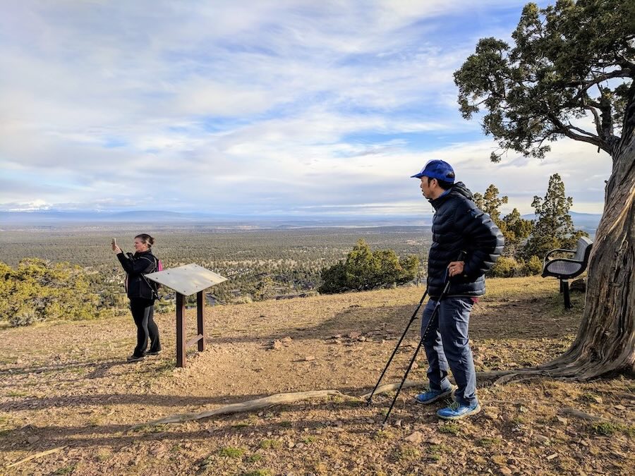
The Cline Butte Loop Trail is a quiet, easy-to-moderate hike near the Eagle Crest resort community. Popular with local residents for daily exercise, it’s rarely crowded and offers some of the best panoramic mountain views near Redmond.
Near: Eagle Crest, about 15 minutes from Redmond, Oregon
Distance: ~2-mile loop (1 hour)
Elevation gain: ~250 ft, with short steep sections
Difficulty: Easy to moderate
Visitors can park in the small gravel lot at the trailhead on Highland View Loop Road. Avoid the gated resident-only entrances; public access is from Coopers Hawk Drive or Eagle Crest Blvd.
The dirt trail climbs gently uphill through juniper forest to a clearing with a bench and a plaque labeling 10+ Cascade peaks, including Three Sisters, Mt. Jefferson, and Mt. Hood. There are a few short steep sections with loose ground, so use caution or bring a walking stick.
The loop passes a few residential areas and follows a mix of dirt and paved paths back to the trailhead. Keep an eye out for deer, rabbits, quail, and other birds along the way. With little shade, bring water, sunscreen, and wear long pants to avoid ticks. Clear days offer the most spectacular views.
Easy Cline Falls Walk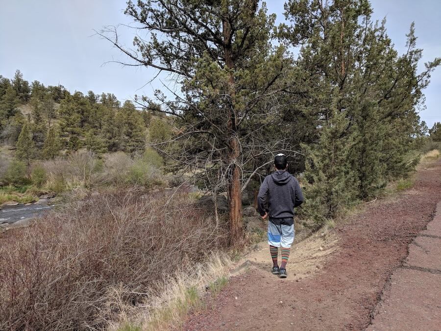
Cline Falls is a short, easy walk along the Deschutes River that ends with a simple waterfall viewpoint tucked into a canyon.
Near: Eagle Crest, ~10 minutes from Redmond
Distance: ~1 mile round trip
Elevation gain: Minimal, with minor ups and downs
Difficulty: Easy
Start from the Cline Falls State Scenic Viewpoint parking lot, which has picnic tables, restrooms, and river access. Several dirt paths lead from the parking area down toward the river; the second path is the most gradual.
The trail parallels the Deschutes, passing under the Mackenzie Highway bridge before reaching the falls. The water drops suddenly into a canyon, with a few good viewpoints where you can admire the cascades and surrounding rock formations.
 You can extend the walk by continuing along the riverside trail past the falls toward houses on the cliffs. The path is relatively flat, making it doable for most hikers – even my dad managed it a month after hip surgery.
Best hikes near Sunriver, Oregon
Sunriver is a hiker’s paradise, and a very popular vacation spot in Central Oregon so we’ve also compiled a list of additional hikes to check out. Distances listed below use Sunriver Resort as a reference point.
Easy hikes
- Benham Falls – 1.5 miles out and back. Cascade and rapids views along the Deschutes River. (10 miles away, 17 min drive)
- Trail of the Molten Land – 1 mile loop. Short volcanic landscape trail with interpretive signs. (7.2 miles away, 16 min)
- Paulina Lakeshore Trail – 7.5 mile loop. Scenic volcanic lake loop with hot springs. (23.5 miles, 32 min)
- Pilot Butte Trail – 1.8 miles out and back. Quick climb with panoramic views of Bend and nearby peaks. (19.1 miles, 29 min)
- Farewell Bend Park – 1.1 mile loop. Flat riverside trail, great for families. (16.6 miles, 23 min)
- Deschutes River Trail – 6.4 miles out and back. Flat, well-maintained river trail; perfect for casual walks. (16.8 miles, 21 min)
Moderate hikes
- Fall River Trail – 6 miles out and back. Old growth forest and clear streams; light elevation. (12.5 miles away, 18 min)
- Lava Butte Trail – 4 miles out and back. Paved trail up a cinder cone with Cascade views. (7.9 miles, 17 min)
- Ann’s Butte Trail – 4.5 mile loop. Gradual incline with views of Broken Top and Mt. Bachelor. (4.4 miles, 11 min)
- Paulina Creek Falls Trail – 5.4 miles out and back. Hike to a double-drop waterfall over volcanic cliffs. (23.2 miles, 32 min)
- Green Lakes Trail – 9.1 miles out and back. Follows Fall Creek to alpine lakes with mountain views. (24.4 miles, 35 min)
- Tumalo Falls Trailhead – 6 miles out and back. Popular trail with several waterfalls, best early in the day. (30.2 miles, 47 min)
- Lava Island Falls Trailhead – 13.2 miles out and back. Long river trail with lava rock formations. (15.5 miles, 32 min)
Difficult/longer hikes
- Peter Skene Ogden Trail – 18 miles out and back. Follows Paulina Creek through pine forest to Paulina Lake. (13.9 miles away, 18 min)
- Tumalo Mountain Trail – 4 miles out and back. Steep summit climb with panoramic mountain views. (19.3 miles, 27 min)
More Oregon posts you might like
Like this post? Pin it for later or share with friends!