Lulumahu Falls hike – Oahu
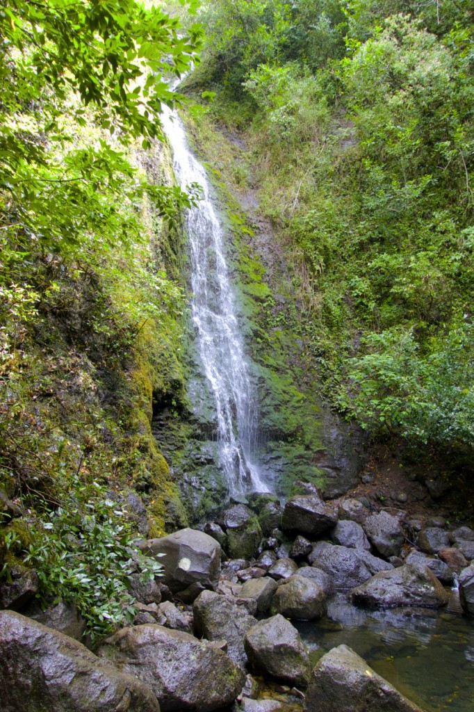
The Lulumahu Falls hike, located just off the Pali Highway on Oahu, is relatively short – but it packs a punch.
This hike, which in the end becomes more of a “scramble,” was not an official, registered trail. After we first tried it, the State enacted and enforced a permit application process for Lulumahu hiking.
Consequently, the trail itself was not maintained and there were no signs telling you where to go. But perhaps this is what makes the destination all the more adventuresome to hikers!
Thanks to directions from Camille C on Yelp (which we’ve adapted and posted below) and advice from several different people we encountered on the way, we eventually found our way to the falls.
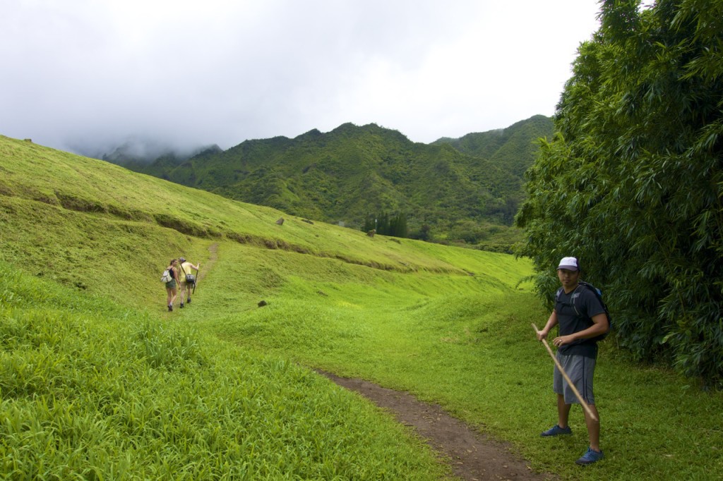
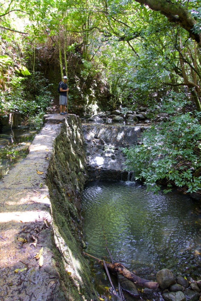
In a short distance, the scenery on this journey changes frequently. From bamboo forest to wide open, grassy hills; man-made reservoir to lush, jungly waterfall.
Updated: 2024. Originally published: March 2015.
Hiking the Lulumahu Falls on Oahu
Lulumahu Falls Hike Details
Hike Distance (Round Trip): 1.6 mi / 2.6 km
Hike Difficulty: Medium
Terrain: Meadow, Forest, Stream Crossings, Loose Dirt, Mud, Boulder Scrambling
Tips for Happy Hiking
If you’re going to attempt this hike, be sure you have good footwear with traction and clothes you don’t mind getting dirty.
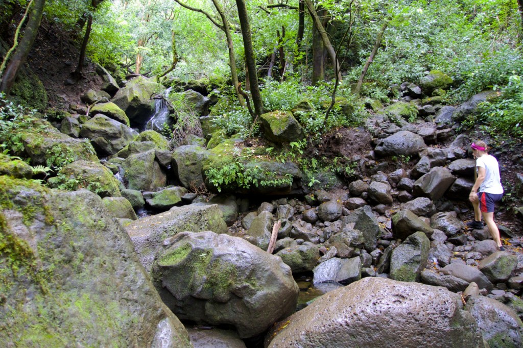
The way up to the falls requires you to cross a creek several times, climb over some boulders and fallen trees, and inevitably sludge through varying quantities of mud.
We picked up a bamboo walking stick at the start of our trek, which was definitely helpful for keeping balance. We also made sure to spray ourselves with mosquito repellent before heading out.
Mosquitoes are common in the area, so make sure to spray yourself with insect repellent before you begin the hike to avoid bites.
Directions for Lulumahu Falls Hiking
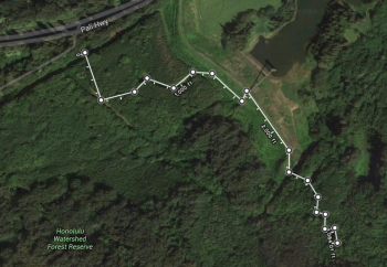
The unofficial parking area is found where the Old Pali Road (Nuuanu) meets up with the Pali Highway, not far from the Kaniakapupu Ruins.
Officially, there is no parking and permitted hikers are advised by the State to get dropped off.
There is an old road next to the Board of Water Supply gate with a large hole in the fence next to the gate.
(Many hikers, after parking, will automatically walk the opposite way towards the wooden sign and mailbox because there is an obvious trail entrance there. You can definitely do that as well, but it will just take you into the bamboo forest, which is less direct.)
If you walk through the opening by the gate, follow the wide path straight. Keep heading straight down the wide path until you reach another set of power lines with a path- take a left.
It will seem as if that left will lead you straight into the bamboo forest, but it’s another nice and easy path cutting right through.
Continue following that curvy path until you reach a large clearing with a nice and open grassy hill.
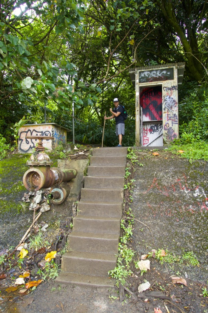
Walk along the path and take the steps up the hill to the reservoir. Follow the gravel road along the reservoir towards the mountain until you see some concrete steps.
Go up the steps and the path will lead you towards this muddy fenced off area. Make your way around to the back of the fence where there’s an opening and small hill. Follow that path to the waterfall.
Always keep close to the creek bed.
You’ll cross through the water over the rocks a few times and the closer you get to the waterfall, the more boulders you will have to hop over and climb.
Some reviews mention following the orange flagged markers, but they may not always be the easiest route. If you stay close to the creek and intuit the way of least resistance, you won’t go astray.
Once you find your way to Lulumahu Falls, simply return the way you came.
Happy hiking!
More about Hiking Lulumahu Falls in Oahu
When is the best time to hike to Lulumahu Falls? Early mornings and weekdays are ideal times to hike to Lulumahu Falls to avoid crowds and heat. The waterfall is most impressive after the rainy season, less so in the summer.
Is the hike suitable for children and beginners? While parts of the trail can be challenging, older children and beginners who are relatively fit should be fine. It’s probably not the best for small children or anyone with mobility issues.
What travel restrictions and rules are in place in Hawaii?
Find post-pandemic travel updates for Hawaii here:
What you need to know about Hawaii travel right now
Ready to do more hiking on Oahu?
Read next: Best Oahu hikes for visitors
You might also like these posts:
Best hikes on Oahu – A visitor’s hiking guide
One Week Oahu Itinerary Ideas
Where to Stay on Oahu
What to pack for a week in Hawaii: Packing Checklist
The Best Sunset and Sunrise Hikes on Oahu
Like this post? Pin it for later or share with a friend!




We did this hike a few years ago and went through the bamboo forest and loved it an experience I will never forget. If I had to choose again I would do the bambo forest for the experience and fun. Adds only 10-15 min more to the hike. We came back the other way you refer to.
Great pics and write up! Love this hike, one of my favorites on Oahu.
My friend and I went to this trial a couple days ago, and after the bamboo trees, there’s was fork in the trail that divides between the right and the left side. The one on the right has the fenced abandoned water pipe where most people would go through to start the trail heading up to Lulumahu Falls. But we went on the trial on the left, where it lead us to crazy obstacles with tangled trees, deadly mosquitos and prickly fern grounds, that were marked with small orange ribbons tried to branches. We kept following the orange ribbons till it lead us to a grassy field in the middle of no where! I’m curious in finding out where the trial ends, and if you have any idea to what I’m talking about please let me know your insight!
Also, great blog! Thanks!
Hey Rachel – Thanks for the comment (and compliment). It sounds like you had a memorable experience. Was the grassy area you ended up at nice? When we did this hike we didn’t encounter the separate trail you mentioned (which now makes me want to go back and see it). I do know that the orange ribbons are usually put there by the government workers that manage the trails or for their own purposes. Sometimes the ribbons are for trails that are not meant for the general public to use. We’ve been on several hikes on Oahu where sometimes the ribbons are extremely helpful and lead us to the place we want to go, and sometimes (like in Aina Haina valley) there are so many different trails with ribbons that you can easily get lost. Anyways, if you ever find out more about the trail you were on at Lulumahu please let us know.
THANK YOU for the GREAT directions! We followed them to the tee!
We’re so glad they were helpful to you!
Thanks for the map showing the general route. There are many descriptions of this hike online but all make it sound so confusing. The map makes it so easy. Thanks again!!
Glad you appreciate the map. It’s kind of confusing no matter what – the best thing we found was to just ask other hikers on the way. But it’s good to research a bit before you go, and we thought having a general idea of the layout from a birds-eye viewpoint would be helpful to people.
Gorgeous pictures! On my to do list for the next time I’m in Hawaii!
Thanks, Stephanie! It’s a fun one. Hope you enjoy it!